|
|
This page was last modified 2024-01-21
| |||||||||||||||||||||||||||||||||||||||||||
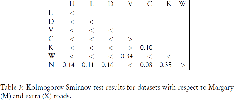
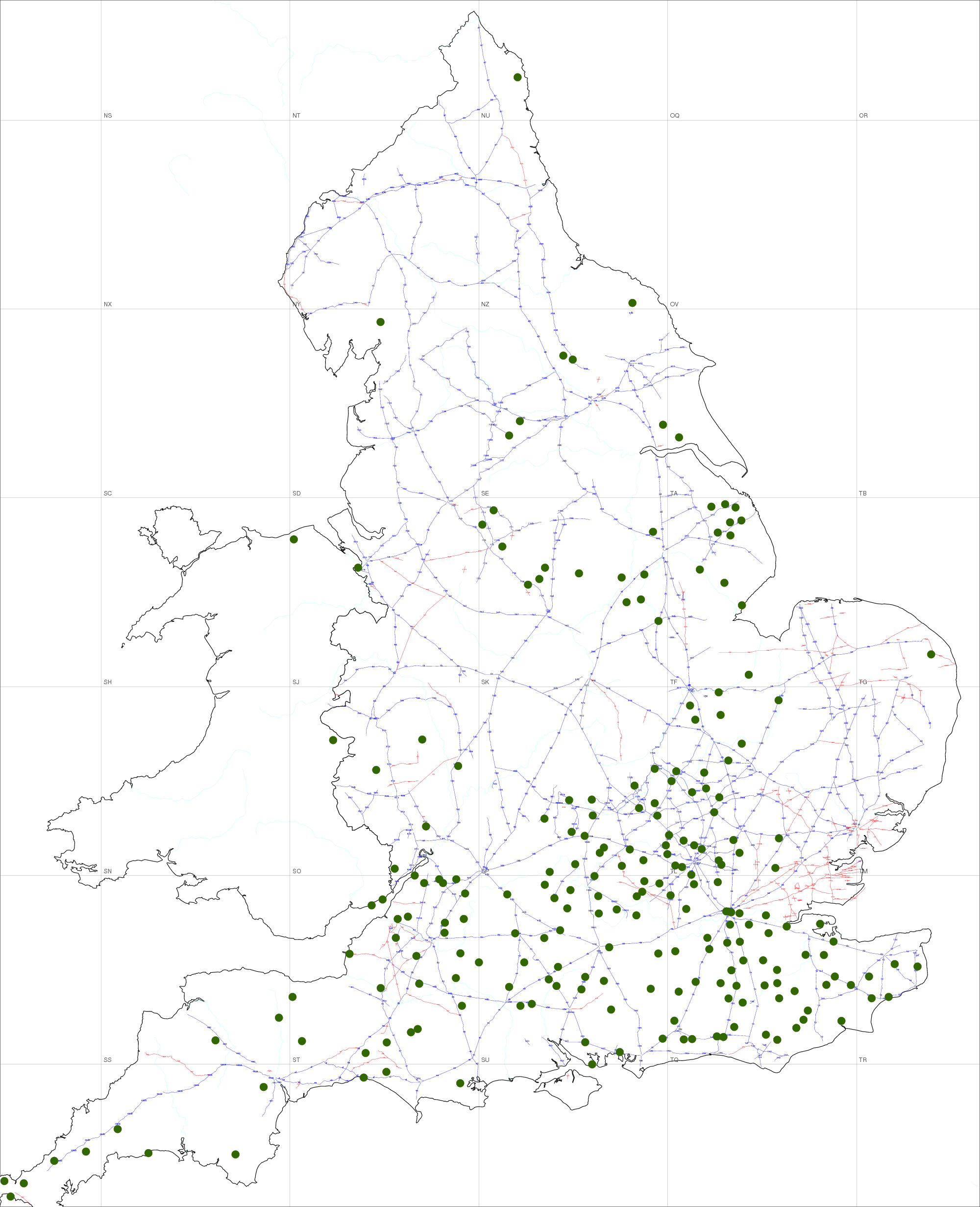
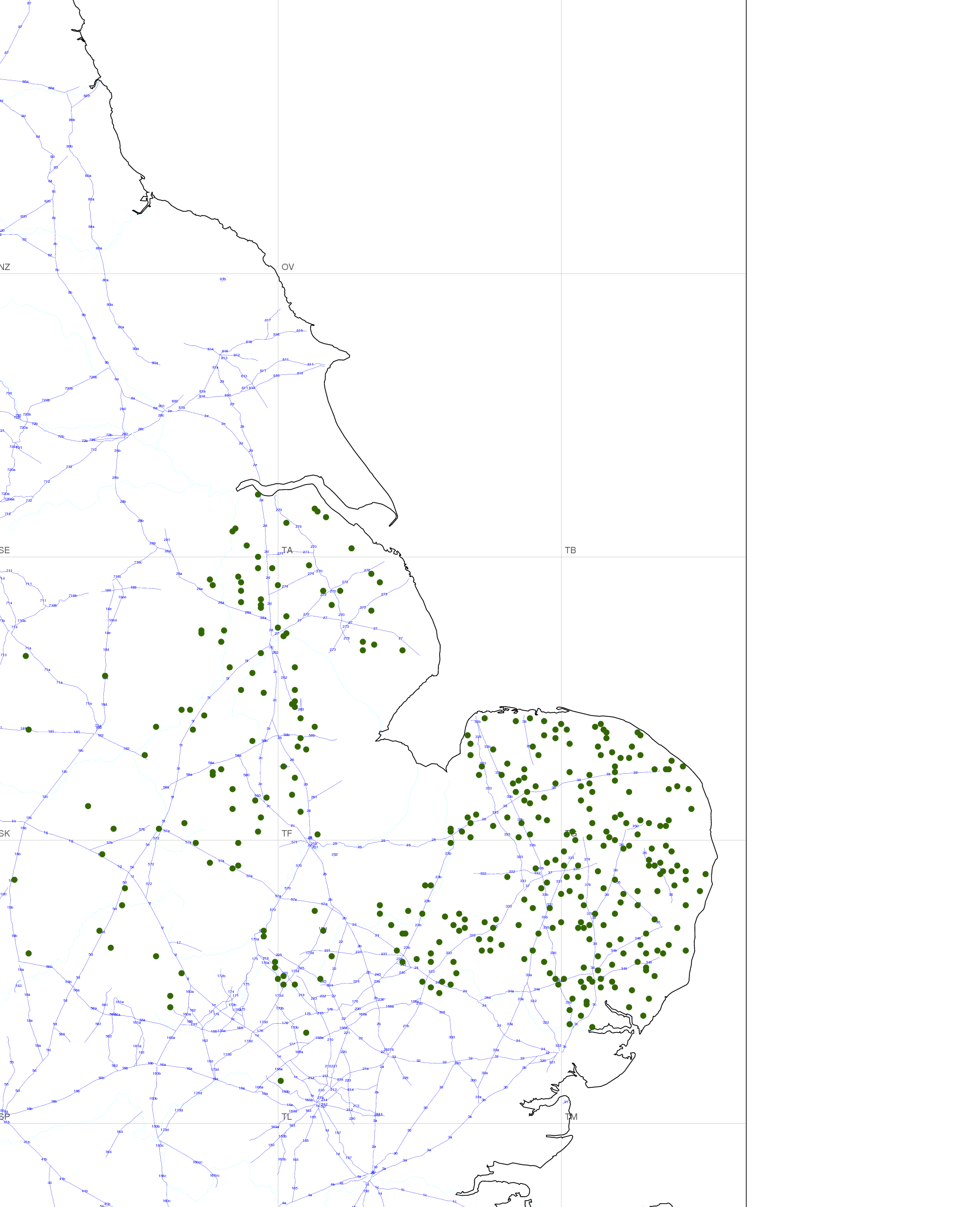
The distribution of distance of certain place-name types to Roman roadsThis article of mine appeared in Nomina 32, 43-57 (2009). ErratumOn page 50, Table 3 has been misprinted as a copy of Table 2. The correct Table 3 is below.
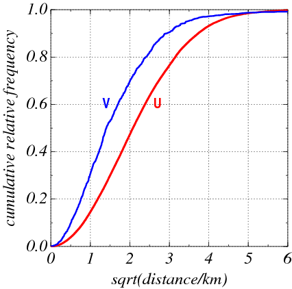
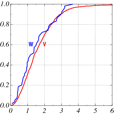
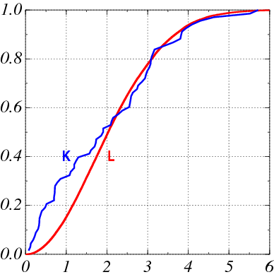
FiguresSince the quality of the printed figures and maps is not very high, I provide here the figure originals as downloadable pdf and png files: Figure 1 (uniform and villas): pdf Figure 2 (villas and wīc-hāms): pdf Figure 3 (height-dependent and Kingstons): pdf Figure 4 (Roman roads and Coldharbours): pdf Figure 5 (Roman roads and -hāms): pdf |