|
|
This page was last modified 2024-01-21
| |||||||||||||||||||||||||||||||||||||||||||
Anglo-Saxon communication networksby Jake Shemming (Thurleston High School) and Keith Briggs (BT Research) It is known that in Anglo-Saxon times, systems of beacons were used, especially along the south coast of England, for defensive purposes. These were fires, set up on hills chosen to be visible from each other. The system seemed to be more than local, so that for example, signals could be sent from the Isle of Wight to the Thames valley. The evidence for such systems has been reviewed in ASBS. Our aim has been to map these beacon sites, discover new ones, and compute their inter-visibility. We can do the last step more accurately than has been done before thanks to the SRTM shuttle elevation data. bécun, weardsetl, tót, ...How do we know where beacon sites might have been? There is, of course, no direct documentary information. The best evidence comes indirectly from those place-names which have early records. These indicate quite clearly where hills that were used for watching were located, but the names alone usually cannot tell us which places were linked to which by signals. This is where our mathematical analysis comes in. There was an Old English (OE) word bécun, from which modern "beacon" descends. But there are not many place-names records of this name from the Anglo-Saxon period. The OE word weardsetl meaning 'watch-point' appears in OE charters with these S number (see Sawyer): 258, 383, 400, 405, 487, 491, 565, 671, 680, 738, and 864. (ASBS p. 162 also claims 1591 contains the word, but we can't find it.) Several of these references are to the same point in Highclere; others are outside the Hampshire-Dorset area, so we have not made use of these. But more work is possible on these sites. Related names also worth searching for include weardhyll and wearddun (S 491 has (of) weardan dune, now Worndown). In Micheldever (S 360) there was a weardhangra. Another word for a look-out point was tót. Here are tables giving some data about places with these names:
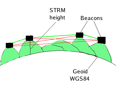
How we calculated inter-visibilityFor each pair of points, we tracked a three-dimensional straight line between them. If the distance was greater than 40km, or the elevation at any point was above the line, the points were classified as not inter-visible. We placed towers of 10m height at each point, to see over local obstructions. The heights of the SRTM data are relative to a reference ellipsoid known as WGS84. The overall calculation should be accurate to within a few metres, and of course takes full account of the curvature of the earth. On our maps, a line is only drawn between two sites if our calculation shows them to be inter-visible.
Pre-Anglo-Saxon signal stations
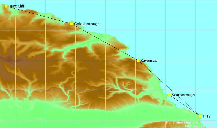
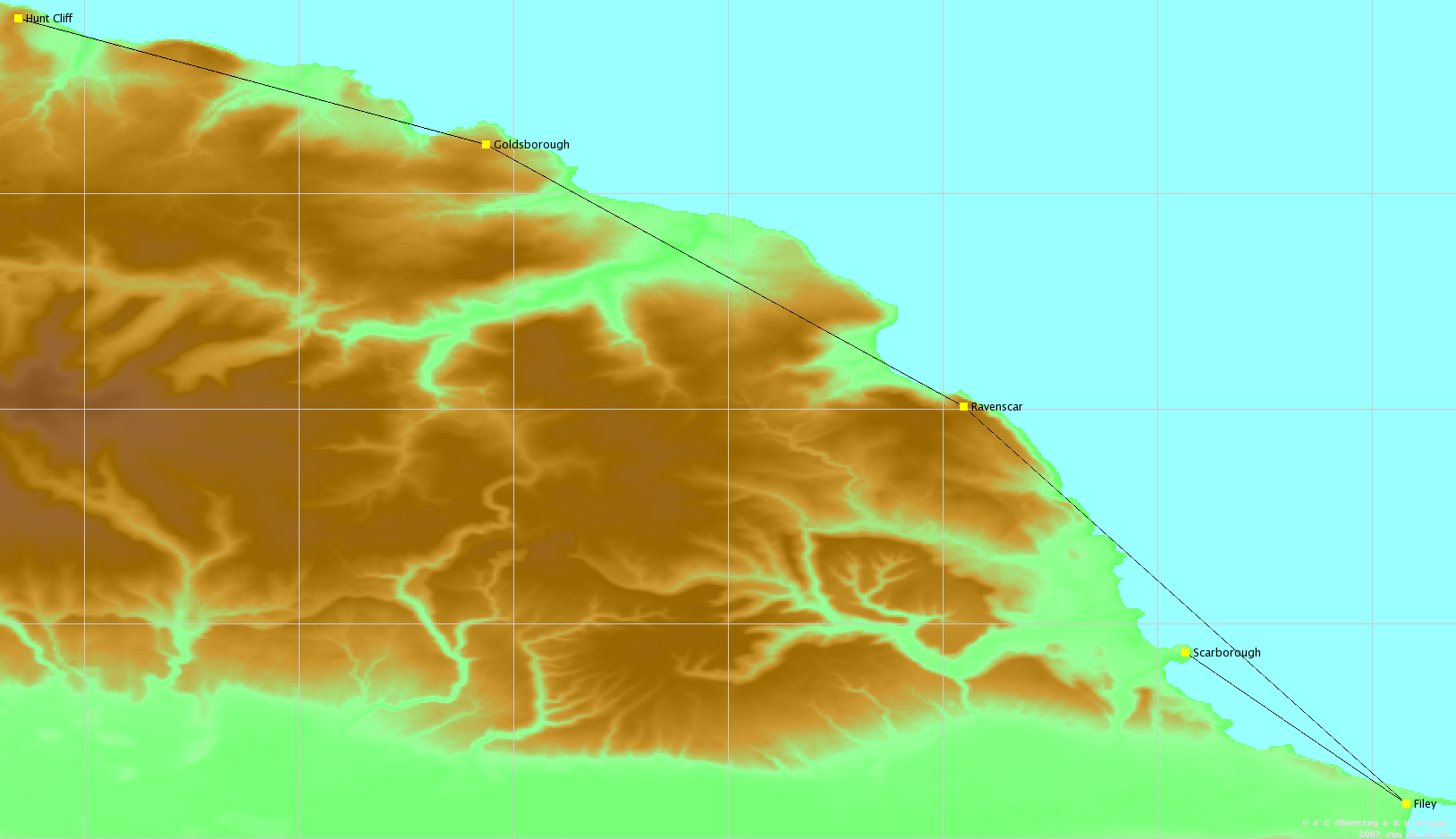
The Romans had five signal stations on the Yorkshire coast, each about 20m high (see Ottoway). The picture is of a tower depicted on Trajan's column in Rome. The individual sites are well studied, but, as far as we know, no-one has yet calculated their inter-visibility. Here is our result. Note that Filey is required as a relay between Scarborough and Ravenscar.
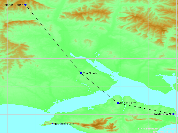
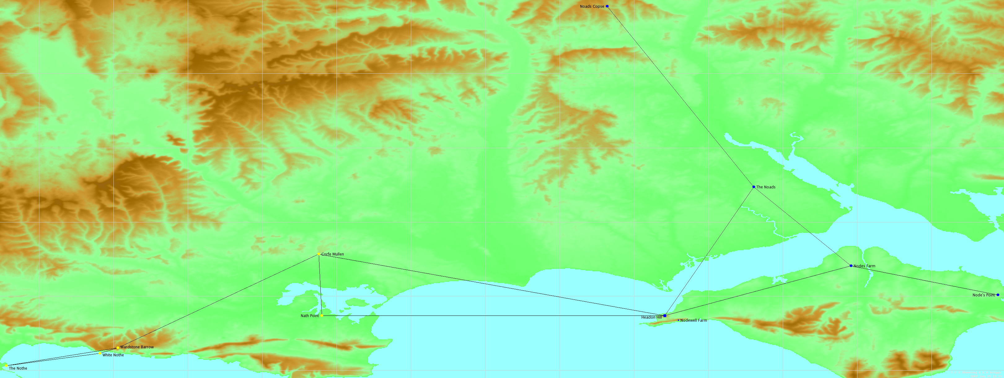
click here for higher-resolution version of above map. Nodes and NothesOne of our main aims has been to study the 'nothe' names of Dorset. It is generally accepted that three Isle of Wight names containing the element "node" are from Old English (atten) ád, meaning 'fire' or 'beacon'. (Here the accent just means a long vowel, normally written with a macron, which html cannot do.) These are (IoW pp 76-77, see also the article ád in VEPN):
Note that this word has no connection to the modern word node used for a hub in a communication network - that word is from Latin nodus, meaning 'knot'. We think a variant *áð might have existed, which would explain these Dorset names:
For these Mills in Do invokes an OE hnoþ which is conjectural, though he does not * it. However, all three Dorset names are in good beacon locations; the last two are coastal, and Nath Point is exactly half-way between Corfe Castle and Poole, and is at the only possible location for a relay station between those points. Thus, our claim will be strengthened if we can show that the Dorset 'nothes' link up to the Hampshire 'nodes'. In the IoW, some lost names like le Ode are known - see VEPN s.v. ád.
click here for higher-resolution version of above map. We were right! This means the Hampshire beacon system described in ASBS does extend into Dorset. We have shown inter-visibility, which strongly supports our conjecture.
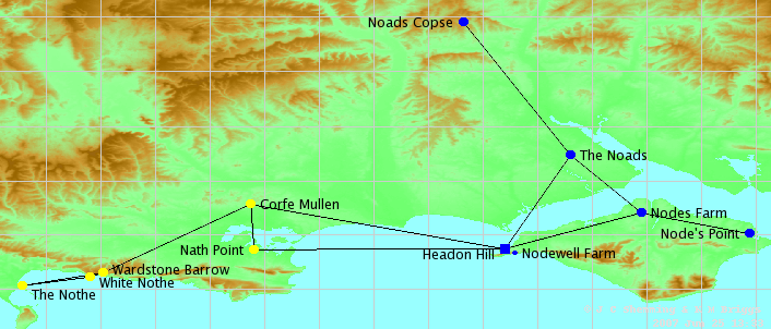
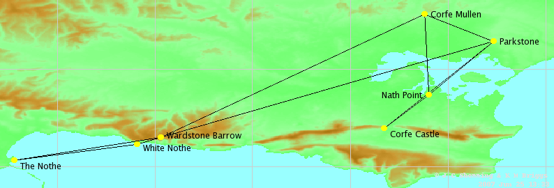
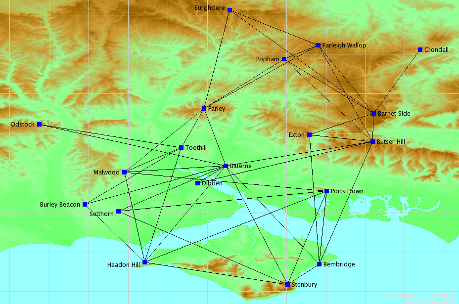
[1] We included Corfe Mullen because it was a likely site of a beacon and helped join the Dorset and Hampshire beacons together, as well as fitting in well with some of the Armada beacon sites. [2] We included Headon Hill as it was near Nodewell Farm and appeared on the Armada beacon map, and so was a likely site of a beacon. By this means we can link the Dorset naths and nothes to the nodes and noad sites of Hampshire. Maps and tables for Node names
click here for higher-resolution version of above map.
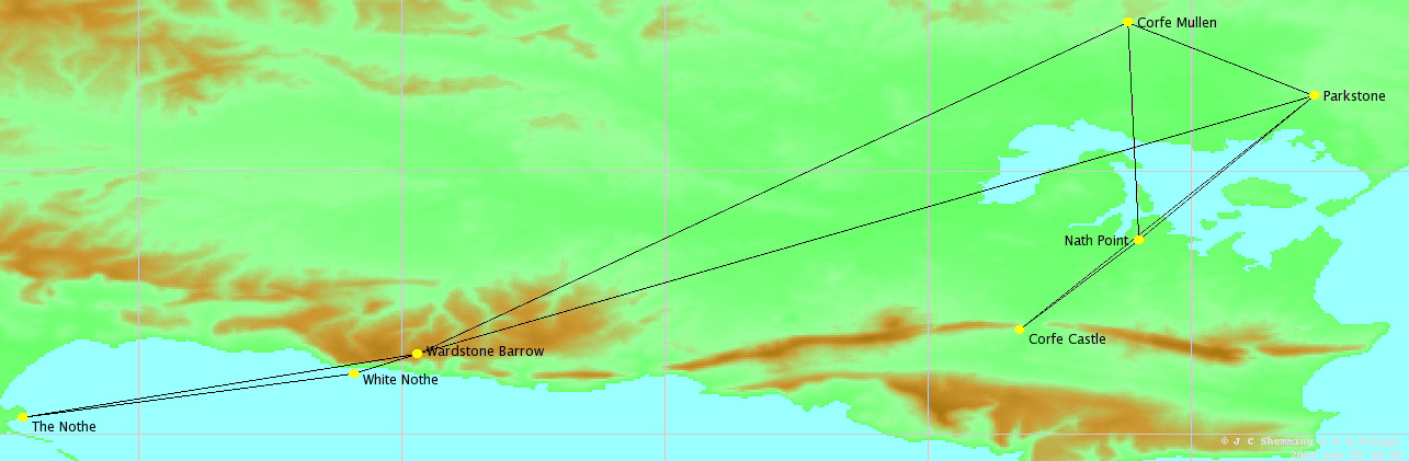
Maps and tables for the Dorset names
click here for higher-resolution version of above map.
Maps and tables for Armada beaconsThe Armada system was used in the 16th century and was studied in BSH. Here we just check the results and do not claim any originality.
click here for higher-resolution version of above map.
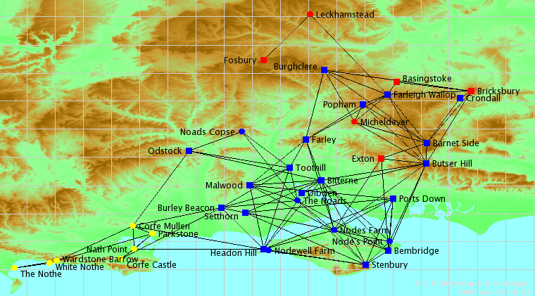
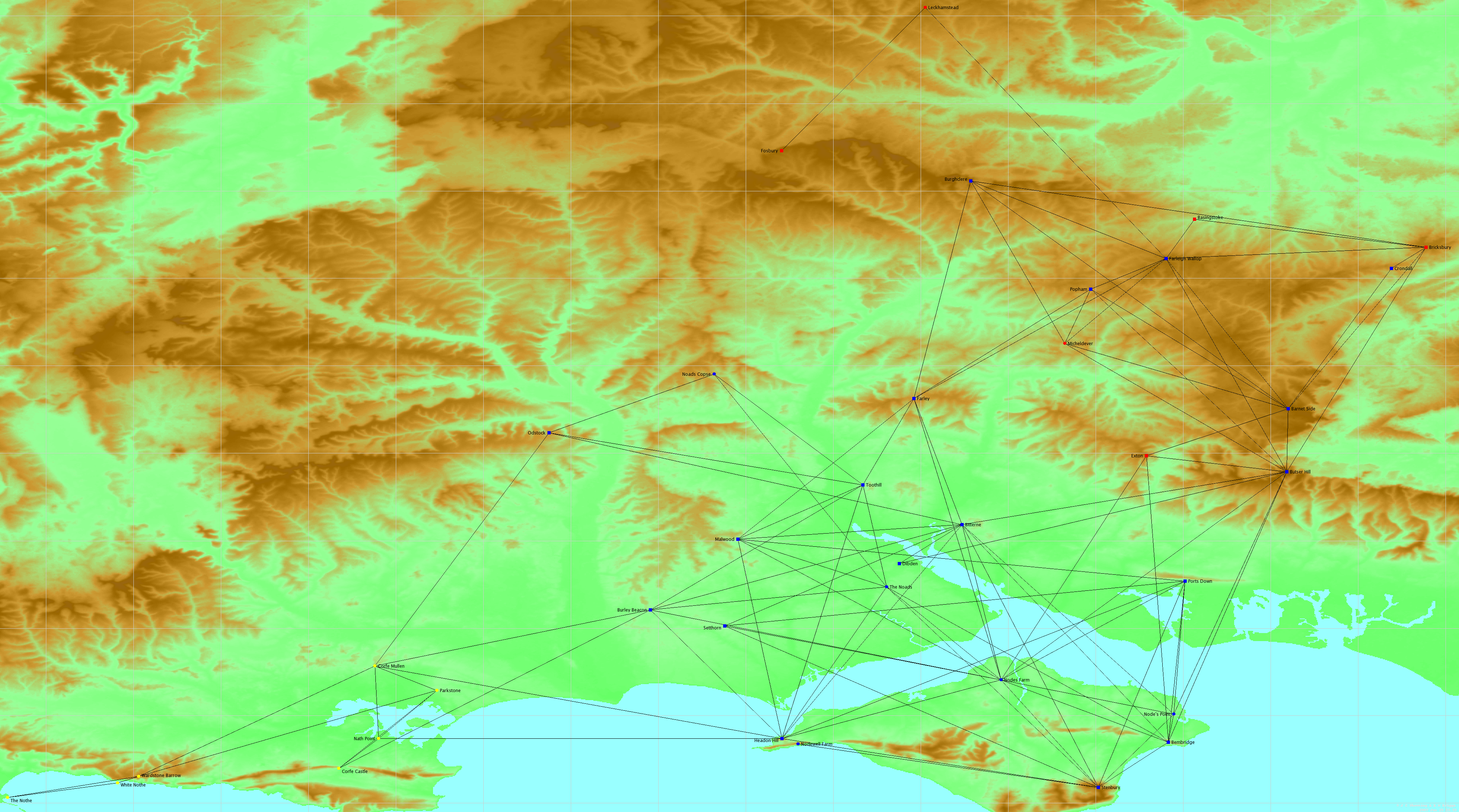
Maps and tables for all names
click here for higher-resolution version of above map.
The meaning of the symbols on the maps
References
|


