|
|
This page was last modified 2024-01-21
| |||||||||||||||||||||||||||||||||||||||||||
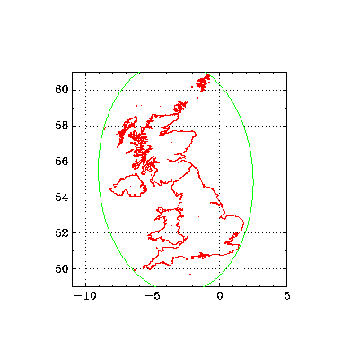
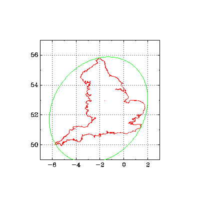
The geometry of Great BritainA complicated coastline such as that of Great Britain provides an interesting example for testing algorithms in computational geometry. In the following examples I use the Mercator projection. centroidHomework exercise: show using Green's theorem that the centroid of a uniform planar lamina is given by boundary integrals: (∫x2dy,∫y2dx)/(2m), where m=∫∫dxdy is the mass. I thus computed the centroid of the mercator projection of England to be at approximately longitude -1.46943, latitude 52.6016. In the national grid coordinate system this is (435930.05,300595.2), or SK359006. This is near Sibson, Leicestershire. enclosing ellipse of minimum areaThe computation of the enclosing ellipse of minimum area is an application of semidefinite programming. The figures show such ellipses for all of GB, including islands, and for England alone.
more to come here...
|


 This website uses no cookies. This page was last modified 2024-01-21 10:57
by