|
|
This page was last modified 2024-01-21
| |||||||||||||||||||||||||||||||||||||||||||
Deramy's Stone, Mersea, EssexI have pieced together the story of this ghost name from fragments in the published literature. I think I have all the available information, but would be grateful to hear about anything I've missed. This forms an addendum to the item at the bottom of page lx of The place-names of Essex by P. Reaney. See also
@article{Crummy_1982,
  author="N. Crummy",
  title="Mersea Island: the eleventh-century boundaries",
  journal="Essex Archaeology and History",
  pages="87-93",
  volume="xiv",
  year="1982",
}
1768Morant publishes his huge History of Essex, which contains on page 416 of volume 1 an extract from a charter said to be from the Archives of Colchester, recording the Mersea estate of St. Ouen in Rouen, which had been given in 1046. Hee sunt terre eorum date Mersege apud Mersege. Ibi est rivus super Pone Streme & extendit usque ad quoddam fossatum vocatum Deramy's-Diche inter Est-Mersey & West Mersey, & à Deramy's-Diche usque ad Deramy's-Flete & à Deramy's-Flete usque ad quandam Stratam vocatum Deramy's-Strete & ibi extendit se usque ad le Peete vocat' Deramy's-Peete villâ de Fyngeryngho ad Deramy's Stone & à Deramy's Stone usque ad brigflete extendit parte orientali & à Deramy's Stone usque ad Weldene-Downes Meowte. Morant adds that he had located "some traces of Deramy's-Diche - from Ponestream on the south-west part, to the north-east side near Bracefleete". He does not explain how the modern English genitives got into the Latin context. 1789The third edition of Camden's Britannia is published (ed. Gough), containing "Pyefleet Creek (antiently called Deramys Fleet)". This is almost certainly taken from Morant. 1923At a meeting in Colchester Town Hall on 26 April (attended by P. H. Reaney), P. Laver speaks on a field trip which visited Deramy Stone. He refers to Morant and gives an English translation of the above Latin text, but does not say where he thinks the stone is. The published version starts "The monument you see before you is, I have no hesitation in saying, one of the oldest in the country.". The map on page 315 of his report has no labels, almost as if somebody forgot to finish it before publication, so this does not help us to locate the site. (See "2008" below.) 1935Reaney published PN Essex, which contains in an addendum on page lx another translation of Morant's text, which he seems to trust. Reaney reminds us that another Colchester charter (post-Conquest) refers to manerium Deremanni. 1957Hart (ECE1) publishes Morant's text (Appendix A, III, pp.23-25). 1962Matthew has discovered (in 1960) another, better, copy of the charter in Rouen, and discusses all the issues in detail (NM, Appendix 1a). He decides that the original A is lost, was copied as B (Rouen) and C (Colchester), and C was copied again (badly) as D by Morant. He recognizes the suspicious features of D, especially the repeated references to Deramy, but cannot explain them. But from B it becomes clear that the bounds were originally in Old English (OE), and Morant's Latin text was mostly likely made by Thomas Jekyll about 1620 (who may have been aware of manerium Deremanni, and made an unwarranted connection). 1966Using the Rouen text with its original OE bounds, Hart (ECEE, p.252) explains Morant's "Deramy" as a mistaken expansion of various OE demonstratives, spelt with ð (the first instance being ðam). This looks convincing, as every occurrence of "Deramy" aligns perfectly with such a demonstrative. The mystery is solved - there never was any Deramy's Stone, Diche etc, just "that stone, ditch" etc. 1970Newton reports the deposition of the Morant MSS collection to the Essex Record Office. Item 1 is the text (C) of c.1325 transcribed by Morant (or Jekyll), which is said to be in bad condition. 1971Hart revises ECE1 and ECE2 to produce ECE3, taking account of the work of Matthew (ECE3, pp.29-30). Hart reports that Morant's original transcript had been found in 1968, and was now in the Essex Record Office as D/DCmZ 18/1. 1975Sue Howlett sent me the following information on 2009-09-22, which comes from a book she is contributing to on Mersea Island. It is reproduced with her permission.
In January, 1975, a ceremony took place on East Mersea Road, beside the parish boundary between East and West Mersea. The Essex County Standard reported police controlling the traffic, while West Mersea's Mayor, Archie Smith, and Dr Alec Grant unveiled a large stone which had been discovered in a field-ditch along the parish boundary. This apparent `glacial erratic' had been triumphantly proclaimed to be the boundary stone mentioned in the King Edward's charter. It was moved to a more visible position beside the road, with a plaque identifying it as `Deremy's Stone - Boundary of the Manor of West Mersea granted by King Edward the Confessor to the Monastery of St. Ouen in 1046'.
Unfortunately, all did not go smoothly at the unveiling ceremony. John Bennett, author of the History of the Parish Churches of East and West Mersea, denounced the event in the harsh words: `I believe there is an element of self-glorification in what has been done here.' He felt strongly that both the date and location of so-called `Deramy's Stone' were wrong. So why was there such outspoken controversy about a simple boundary stone, and how did it acquire its distinctive name?
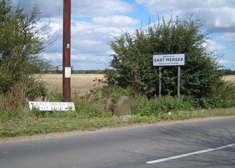
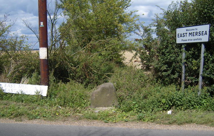
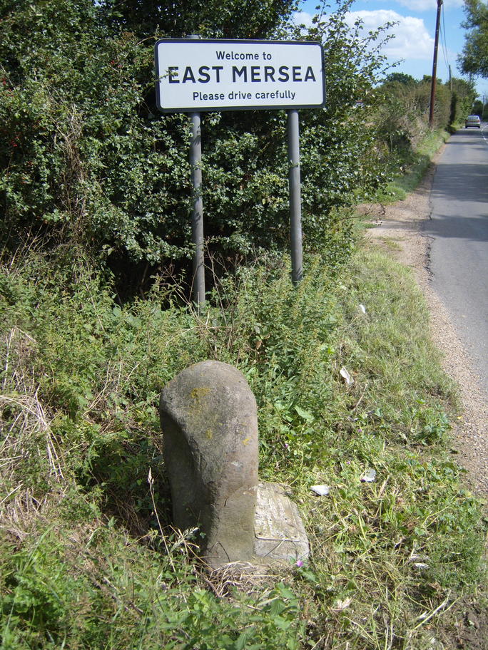
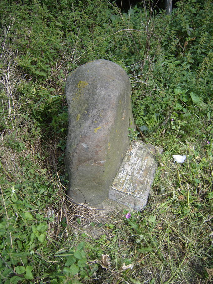
2008We see that "Deramy's Stone" has been given a artificial reality by: The Morant document is now in the Essex Record Office in Chelmsford as part of the Morant MSS collection as D/Y 2/1. A stone at TM 036 142 on the East Mersea Road near the old rectory at East Mersea (near the sign for the youth camp turning) is a marker for the boundary of West Mersea and East Mersea parish. It has un unreadable plaque, but it is just possible to read the start of the inscription as "Der...". It is very likely the site of the 1923 EAS visit. Photos of this taken by me on 2008-08-23 are below.
References
|