|
|
This page was last modified 2024-01-21
| |||||||||||||||||||||||||||||||||||||||||||
|
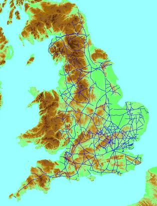
NB: this material is obsolete. The final version of it appeared in my paper in Nomina 32 (2009) 43. The distribution of distance to Roman roads in EnglandIntroduction
We sometimes read claims in articles about place-names that certain place-name types occur more frequently near to Roman roads. For example:
It would seem necessary to test these hypotheses statistically. Such a study was done for the name Coldharbour by Trevor Ogden in Coldharbour and Roman Roads, Durham University Journal 59, 13-24 (1966). A positive result was found - Coldharbours are closer to Roman roads than randomly distributed points. However, the author has since revised his opinion, because it has become clear that the control group should not be randomly distributed points. It might be that all settlements are closer to Roman roads than randomly distributed points. Furthermore, with respect to Coldharbour names, Richard Coates has convincingly demonstrated in Nomina 8, 73-78 (1984) that the name has a mostly post-1600 origin, and no connection to Roman roads is at all likely. I have thus started a re-examination of these ideas. With modern computing methods, much more precise statistical information should be obtainable.
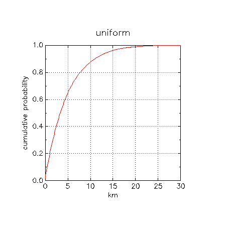
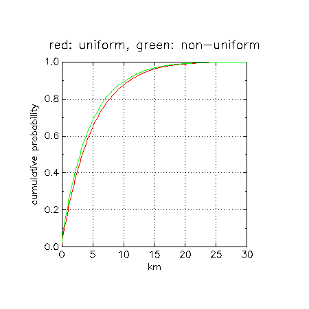
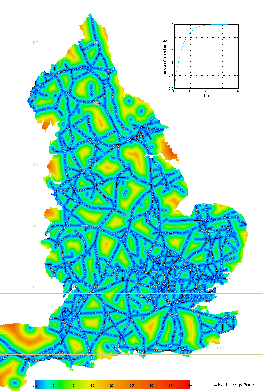
We conclude that the median distance is about 3.5km. In other words, half of all points in England are within 3.5km of a Roman road, and so being 3.5km or less from a Roman road should not be considered unusual. Of course, having more than one point close to a road is always less likely, if they are independently distributed. I am in the process of computing more detailed data for Mills' -ham names. Incidentally, these calculations involve some interesting computational geometry - good, fast algorithms are required for the point-in-polygon test, and for distance to the nearest of a given finite set of straight line segments. England - distance map
|
 This website uses no cookies. This page was last modified 2024-01-21 10:57
by
This website uses no cookies. This page was last modified 2024-01-21 10:57
by